mapbox_polyline_points
A flutter plugin that allow you to user mapbox direction api into google map
|
Getting Started
This package contains List of List coordinates that allow you to more that one routes
Usage
To use this package, add mapbox_polyline_points as a dependency in your pubspec.yaml file.
Import the package
import 'package:mapbox_polyline_points/mapbox_polyline_points.dart';
method
Get the list of points by Geo-coordinate, this return an instance of MapboxPolylineResult, which contains the status of the api, the errorMessage, and the list of decoded points.
MapboxPolylinePoints mapboxPolylinePoints = MapboxPolylinePoints();
MapboxPolylineResult result = await mapboxPolylinePoints.getRouteBetweenCoordinates(mapboxAPiKey,
        _originLatitude, _originLongitude, _destLatitude, _destLongitude);
print(result.points);
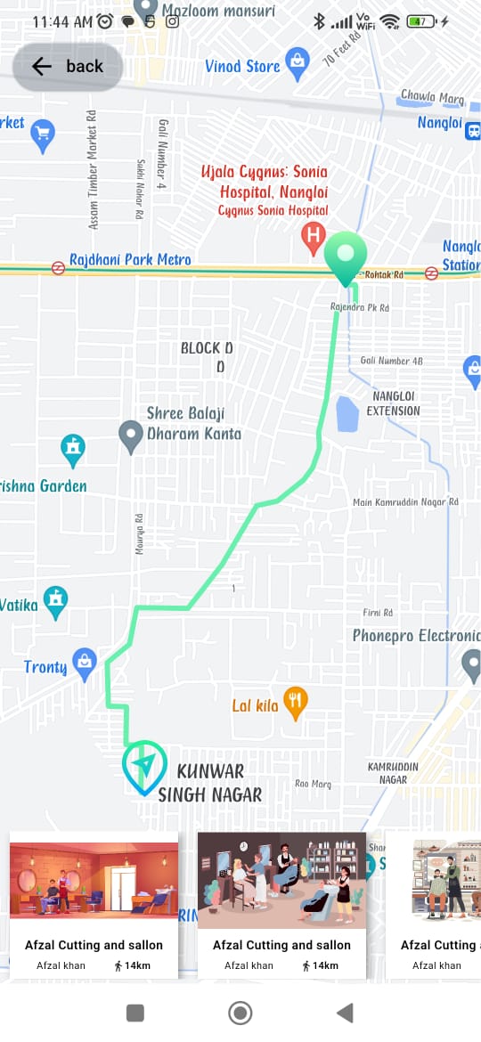
example
import 'dart:convert';
import 'package:barbar_saloon/common/colors.dart';
import 'package:flutter/material.dart';
import 'package:geolocator/geolocator.dart';
import 'package:google_maps_flutter/google_maps_flutter.dart';
import 'package:mapbox_polyline_points/mapbox_polyline_points.dart';
const LatLng _currentPosition = LatLng(28.6817149, 77.0534036);
const LatLng _currentPosition1 = LatLng(28.6277039, 77.1424405);
const LatLng _currentPosition2 = LatLng(40.698432, -73.924038);
const LatLng _currentPosition3 = LatLng(28.6730915, 77.0384241);
const LatLng _currentPosition4 = LatLng(28.6730915, 77.0384241);
class MapScreen extends StatefulWidget {
static const String routerName = "/map_screen";
const MapScreen({super.key});
@override
State<MapScreen> createState() => _MapScreenState();
}
class _MapScreenState extends State<MapScreen> {
List<Marker>? _markers = [];
bool? _serviceEnabled;
late Position _locationData;
LatLng? _center;
List<List<LatLng>> polylineCoordinates = [];
GoogleMapController? mapController;
Map<PolylineId, Polyline> polylines = {};
MapboxPolylinePoints mapboxpolylinePoints = MapboxPolylinePoints();
@override
void initState() {
// TODO: implement initState
super.initState();
_determinePosition();
}
void _determinePosition() async {
bool serviceEnabled;
LocationPermission permission;
serviceEnabled = await Geolocator.isLocationServiceEnabled();
if (!serviceEnabled) {
return Future.error('Location services are disabled.');
}
permission = await Geolocator.checkPermission();
if (permission == LocationPermission.denied) {
permission = await Geolocator.requestPermission();
if (permission == LocationPermission.denied) {
return Future.error('Location permissions are denied');
}
}
if (permission == LocationPermission.deniedForever) {
return Future.error(
'Location permissions are permanently denied, we cannot request permissions.');
}
_locationData = await Geolocator.getCurrentPosition();
_getPolyline();
setState(() {
_center = LatLng(_locationData.latitude, _locationData.longitude);
});
}
_addPolyLine() {
PolylineId id = PolylineId("poly");
Polyline polyline = Polyline(
polylineId: id,width: 5, color: Colors.greenAccent, points: polylineCoordinates[0]);
polylines[id] = polyline;
setState(() {});
}
void _getPolyline() async {
MapboxPolylineResult result = await mapboxpolylinePoints.getRouteBetweenCoordinates(
'pk.eyJ1IjoiYWxva2phZGhhdiIsImEiOiJjbGNnNGQxZGUwcmNiM3lrNTM3YjFnaWc4In0.4sdA4V90-ZAsGyxKxuNLiw',
PointLatLng(latitude: _locationData.latitude,longitude: _locationData.longitude),
PointLatLng(latitude: _currentPosition.latitude, longitude: _currentPosition.longitude),
TravelType.walking
);
if (result.points.isNotEmpty){
for (List<PointLatLng> element in result.points) {
polylineCoordinates.add(decodeEncodedPolyline(element));
}
}
_addPolyLine();
}
List<LatLng> decodeEncodedPolyline(List<PointLatLng> encoded) {
List<LatLng> poly = [];
for (int i = 0; i < encoded.length; i++) {
poly.add(LatLng(encoded[i].latitude,encoded[i].longitude));
}
return poly;
}
List<Map> listSaloon = [
{
"image": "assets/images/outlate.jpg",
"shop-name": "Afzal Cutting and sallon",
"name": "Afzal khan",
"distance": "14km"
},
{
"image": "assets/images/outlet2.jpg",
"shop-name": "Afzal Cutting and sallon",
"name": "Afzal khan",
"distance": "14km"
},
{
"image": "assets/images/outlet3.jpg",
"shop-name": "Afzal Cutting and sallon",
"name": "Afzal khan",
"distance": "14km"
},
{
"image": "assets/images/outlet4.jpg",
"shop-name": "Afzal Cutting and sallon",
"name": "Afzal khan",
"distance": "14km"
},
{
"image": "assets/images/outlet5.jpg",
"shop-name": "Afzal Cutting and sallon",
"name": "Afzal khan",
"distance": "14km"
},
];
@override
Widget build(BuildContext context) {
Size size = MediaQuery.of(context).size;
return Scaffold(
body: (_center == null)
? const Center(child: CircularProgressIndicator())
: SizedBox(
width: size.width,
height: size.height,
child: Stack(
children: [
SizedBox(
width: size.width,
height: size.height,
child: GoogleMap(
initialCameraPosition: CameraPosition(
target: _center!,
zoom: 16,
),
onMapCreated: (controller) async {
mapController = controller;
var currentMarker = await BitmapDescriptor.fromAssetImage(
ImageConfiguration.empty,
"assets/images/location.png");
var markerIcon =
await BitmapDescriptor.fromAssetImage(
ImageConfiguration.empty,
"assets/images/locations.png");
_markers = [
Marker(
markerId: const MarkerId("djf0"),
position: LatLng(_locationData.latitude,
_locationData.longitude),
icon: currentMarker,
onTap: () {
_center = LatLng(_locationData.latitude,
_locationData.longitude);
setState(() {});
}),
Marker(
markerId: const MarkerId("djf"),
position: _currentPosition,
icon: markerIcon,
onTap: () {
_center = _currentPosition;
setState(() {});
},
),
Marker(
markerId: const MarkerId("djf1"),
position: _currentPosition1,
icon: markerIcon,
onTap: () {
_center = _currentPosition1;
setState(() {});
},
),
Marker(
markerId: const MarkerId("djf2"),
position: _currentPosition2,
icon: markerIcon,
onTap: () {
_center = _currentPosition2;
setState(() {});
},
),
Marker(
markerId: const MarkerId("djf3"),
position: _currentPosition3,
icon: markerIcon,
onTap: () {
_center = _currentPosition3;
setState(() {});
},
),
Marker(
markerId: const MarkerId("djf5"),
position: _currentPosition4,
icon: markerIcon,
onTap: () {
_center = _currentPosition4;
setState(() {});
},
),
];
setState(() {});
},
markers: _markers!.asMap().values.toSet(),
myLocationButtonEnabled: true,
polylines: Set<Polyline>.of(polylines.values),
),
),
Positioned(
bottom: 4,
left: 0,
child: SizedBox(
width: size.width,
height: size.height * 0.15,
child: ListView.builder(
itemCount: listSaloon.length,
scrollDirection: Axis.horizontal,
itemBuilder: (context, index) => InkWell(
onTap: () => _getPolyline(),
child: Container(
width: size.width * 0.35,
height: size.height * 0.15,
margin: EdgeInsets.symmetric(horizontal: 8.0),
decoration: BoxDecoration(
color: Colors.white,
boxShadow: [
BoxShadow(
offset: Offset(2.5, 2.5),
blurRadius: 5,
color: shadowcolor,
)
]),
child: Flex(
direction: Axis.vertical,
crossAxisAlignment: CrossAxisAlignment.center,
children: [
Expanded(
flex: 2,
child: Image.asset(
listSaloon[index]["image"],
fit: BoxFit.fitWidth,
)),
Expanded(
child: Column(
mainAxisAlignment: MainAxisAlignment.spaceEvenly,
children: [
Text(listSaloon[index]["shop-name"],
style: TextStyle(fontSize: 10.0,fontWeight: FontWeight.w600,color:blackcolor)),
Row(
mainAxisAlignment: MainAxisAlignment.spaceEvenly,
crossAxisAlignment: CrossAxisAlignment.center,
children: [
Text(listSaloon[index]["name"],
style: TextStyle(fontSize: 8.0,fontWeight:FontWeight.w400,color:blackcolor)),
Row(
children: [
Icon(Icons.directions_walk,size: 10,),
Text(listSaloon[index]["distance"],
style: TextStyle(
fontSize: 8.0,
fontWeight: FontWeight.w600,color: blackcolor))
],
),
],
),
]))
],
),
),
),
),
),
),
Positioned(
top: 30,
left:10,
child: ElevatedButton.icon(
style: ElevatedButton.styleFrom(
foregroundColor: blackcolor,
backgroundColor: Colors.white.withOpacity(0.2)
),
onPressed: (){
Navigator.pop(context);
}, icon: const Icon(Icons.arrow_back), label: const Text('back')))
],
),
));
}
}
// also you can add distance and durations and result is a instance of MapboxPolylineResult
double distance = (result.distance[0].floor()) / 1000;
print(distance);
double seconds = result.distance[0];
// Convert the seconds to a Duration object
Duration duration = Duration(seconds: seconds.toInt());
// Extract the hours, minutes, and remaining seconds from the Duration
int hours = duration.inHours;
int minutes = duration.inMinutes.remainder(60);
int remainingSeconds = duration.inSeconds.remainder(60);
// Print the result
print('$hours hours $minutes minutes $remainingSeconds seconds');
Hint
kindly ensure you use a valid mapbox direction api key,
If you need help generating direction api key for your project click this link