flutter_osm_plugin 0.50.0-alpha.4  flutter_osm_plugin: ^0.50.0-alpha.4 copied to clipboard
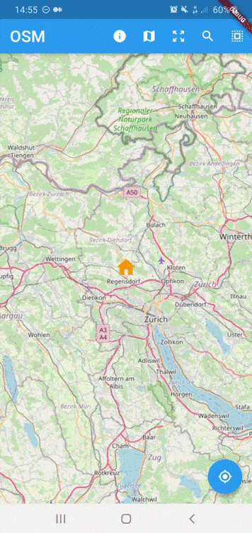
OpenStreetMap Plugin Native for flutter apps (Andoird/iOS supported,web is under-dev)
flutter_osm_plugin #
Platform Support #
| Android | iOS | Web |
|---|---|---|
| supported ✔️ | supported ✔️ (min iOS supported : 12) | 0.50.0-alpha.4 |
osm plugin for flutter apps
- current position (Android/iOS/web)
- change position (Android/iOS/web)
- create Marker manually (Android/iOS/web)
- tracking user location (Android/iOS/web)
- customize Icon Marker (Android/iOS/web)
- customize user Marker (Android/iOS/web)
- assisted selection position (Android/iOS)
- set BoundingBox (Android)
- zoom into regon (Android/iOS)
- draw Road,recuperate information (duration/distance) of the current road (Android/iOS/web)
- draw Road manually (Android/iOS/web)
- draw multiple Roads (Android)
- ClickListener on Marker (Android/iOS/web)
- ClickListener on Map (Android/iOS/web)
- calculate distance between 2 points
- address suggestion
- draw shapes (Only Android)
- simple dialog location picker (Android/iOS)
- listen to region change (Android/iOS)
- set custom tiles (Android,iOS)
Getting Started #
Installing #
Add the following to your pubspec.yaml file:
dependencies:
  flutter_osm_plugin: ^0.50.0-alpha.4
Web integration #
Add this line below 👇 in index.html in web folder
<script src="packages/flutter_osm_web/src/asset/map_init.js"></script>
Note We have limitation in handling user interaction in the map inside our plugin, if you put button on the top of the map and you listen to click on the map both will be fired
Migration to 0.34.0 (Android Only) #
if you are using this plugin before Flutter 3
you should make some modification in build.gradle before that run flutter clean && flutter pub get
open file build.gradle inside android file
* change kotlin version from `1.5.21` to `1.6.21`
* change gradle version from `7.0.2` to `7.1.3` or `7.0.4`
* change compileSdkVersion to 32
Migration to 0.16.0 (Android Only) #
if you are using this plugin before Flutter 2
you should make some modification in build.gradle before that run flutter clean && flutter pub get
open file build.gradle inside android file
* change kotlin version from `1.4.21` to `1.5.21`
* change gradle version from `4.1.1` to `7.0.2`
Simple Usage #
Creating a basic OSMFlutter :
 OSMFlutter(
        controller:mapController,
        trackMyPosition: false,
        initZoom: 12,
        minZoomLevel: 8,
        maxZoomLevel: 14,
        stepZoom: 1.0,
        userLocationMarker: UserLocationMaker(
            personMarker: MarkerIcon(
                icon: Icon(
                    Icons.location_history_rounded,
                    color: Colors.red,
                    size: 48,
                ),
            ),
            directionArrowMarker: MarkerIcon(
                icon: Icon(
                    Icons.double_arrow,
                    size: 48,
                ),
            ),
        ),
         roadConfiguration: RoadConfiguration(
                startIcon: MarkerIcon(
                  icon: Icon(
                    Icons.person,
                    size: 64,
                    color: Colors.brown,
                  ),
                ),
                roadColor: Colors.yellowAccent,
        ),
        markerOption: MarkerOption(
            defaultMarker: MarkerIcon(
                icon: Icon(
                  Icons.person_pin_circle,
                  color: Colors.blue,
                  size: 56,
                  ),
                )
        ),
    );
MapController #
Declare
MapControllerto control OSM map
1) Initialisation
 MapController controller = MapController(
                            initMapWithUserPosition: false,
                            initPosition: GeoPoint(latitude: 47.4358055, longitude: 8.4737324),
                            areaLimit: BoundingBox( east: 10.4922941, north: 47.8084648, south: 45.817995, west: 5.9559113,),
                       );
2) Dispose
controller.dispose();
3) Properties of MapController
| Properties | Description |
|---|---|
initMapWithUserPosition |
(bool) initialize map with user position (default:true |
initPosition |
(GeoPoint) if it isn't null, the map will be pointed at this position |
areaLimit |
(Bounding) set area limit of the map (default BoundingBox.world()) |
customLayer |
(CustomTile) set customer layer using different osm server , this attribute used only with named constructor customLayer |
3.1) Custom Layers with MapController
- To change the tile source in OSMFlutter, you should used our named constructor
customLayer, see the example below
controller = MapController.customLayer(
      initMapWithUserPosition: false,
      initPosition: GeoPoint(
        latitude: 47.4358055,
        longitude: 8.4737324,
      ),
      customTile: CustomTile(
        sourceName: "opentopomap",
        tileExtension: ".png",
        minZoomLevel: 2,
        maxZoomLevel: 19,
        urlsServers: [
         TileURLs(
            url: "https://tile.opentopomap.org/",
            subdomains: [],
          )
        ],
        tileSize: 256,
      ),
    )
- also,you can use our predefined custom tiles like
cyclOSMLayerconstructor for cycling tilespublicTransportationLayerconstructor for transport tiles ,it's public osm server
for more example see our example in home_example.dart
4) Set map on user current location
await controller.currentLocation();
5) Zoom IN
 await controller.setZoom(stepZoom: 2);
 // or
 await controller.zoomIn();
5.1) Zoom Out
 await controller.setZoom(stepZoom: -2);
 // or
 await controller.zoomOut();
5.2) change zoom level
zoomLevelshould be betweenminZoomLevelandmaxZoomLevel
await controller.setZoom(zoomLevel: 8);
5.3) zoom to specific bounding box
await controller.zoomToBoundingBox(BoundingBox(),paddingInPixel:0)
Note :
- For the box attribute ,If you don't have bounding box,you can use list of geopoint like this
BoundingBox.fromGeoPoints
6) get current zoom level b>
await controller.getZoom();
7) BoundingBox
set bounding box in the map
await controller.limitAreaMap(BoundingBox( east: 10.4922941, north: 47.8084648, south: 45.817995, west: 5.9559113,));
remove bounding box in the map
await controller.removeLimitAreaMap();
8) Track user current position
for iOS,you should add those line in your info.plist file
   <key>NSLocationWhenInUseUsageDescription</key>
	<string>any text you want</string>
	<key>NSLocationAlwaysUsageDescription</key>
	<string>any text you want</string>
from version 0.40.0 we can call only
enableTrackingwill animate to user location without need to callcurrentLocation
await controller.enableTracking();
9) Disable tracking user position
await controller.disabledTracking();
10) update the location
this method will create marker on that specific position
await controller.changeLocation(GeoPoint(latitude: 47.35387, longitude: 8.43609));
Change the location without create marker
await controller.goToLocation(GeoPoint(latitude: 47.35387, longitude: 8.43609));
11) recuperation current position
GeoPoint geoPoint = await controller.myLocation();
12) get center map b>
GeoPoint centerMap = await controller.centerMap;
12.1) get geoPoint in the map b>
- recuperate geoPoint of marker add it by user except static points
List<GeoPoint> geoPoints = await controller.geopoints;
13) get bounding box map b>
BoundingBox bounds = await controller.bounds;
14) select/create new position
- we have 2 way to select location in map
14.1 Manual selection (deprecated)
a) select without change default marker
GeoPoint geoPoint = await controller.selectPosition();
b) select position with dynamic marker
- Flutter widget
 GeoPoint geoPoint = await controller.selectPosition(
     icon: MarkerIcon(
                      icon: Icon(
                        Icons.location_history,
                        color: Colors.amber,
                        size: 48,
          ),
);
- image from network
 GeoPoint geoPoint = await controller.selectPosition(
         imageURL: "https://raw.githubusercontent.com/PokeAPI/sprites/master/sprites/pokemon/back/1.png"
);
c) select using listener from controller directly
- for more example see home_example.dart c.1) single tap listener
controller.listenerMapSingleTapping.addListener(() {
      if (controller.listenerMapSingleTapping.value != null) {
        /// put you logic here
      }
    });
c.2) long tap listener
controller.listenerMapLongTapping.addListener(() {
      if (controller.listenerMapLongTapping.value != null) {
        /// put you logic here
      }
    });
c.3) region change listener
controller.listenerRegionIsChanging.addListener(() {
      if (controller.listenerRegionIsChanging.value != null) {
        /// put you logic here
      }
    });
14.2 Assisted selection (for more details see example)
 /// To Start assisted Selection
 await controller.advancedPositionPicker();
 /// To get location desired
  GeoPoint p = await controller.getCurrentPositionAdvancedPositionPicker();
  /// To get location desired and close picker
 GeoPoint p = await controller.selectAdvancedPositionPicker();
 /// To cancel assisted Selection
 await controller.cancelAdvancedPositionPicker();
15) Create Marker Programmatically
you can change marker icon by using attribute
markerIcon
await controller.addMarker(GeoPoint,markerIcon:MarkerIcon,angle:pi/3);
15.1) Change Icon Marker
You can change marker icon by using attribute
markerIconof existing Marker The GeoPoint/Marker should be exist
await controller.setMarkerIcon(GeoPoint,MarkerIcon);
15.2) Remove marker
await controller.removeMarker(geoPoint);
- PS : static position cannot be removed by this method
16) Draw road,recuperate distance in km and duration in sec
you can add an middle position to pass your route through them change configuration of the road in runtime zoom into the region of the road change the type of the road that user want to use
 RoadInfo roadInfo = await controller.drawRoad(
   GeoPoint(latitude: 47.35387, longitude: 8.43609),
   GeoPoint(latitude: 47.4371, longitude: 8.6136),
   roadType: RoadType.car,
   intersectPoint : [ GeoPoint(latitude: 47.4361, longitude: 8.6156), GeoPoint(latitude: 47.4481, longitude: 8.6266)]
   roadOption: RoadOption(
       roadWidth: 10,
       roadColor: Colors.blue,
       showMarkerOfPOI: false,
       zoomInto: true,
   ),
);
 print("${roadInfo.distance}km");
 print("${roadInfo.duration}sec");
properties of RoadOption #
| Properties | Description |
|---|---|
roadColor |
(Color?) change the default color of the route in runtime |
roadWidth |
(int?) change the road width |
showMarkerOfPOI |
(bool) change the visibility of the markers of the POI (default:false) |
zoomInto |
(bool) change zoom level to make the all the road visible (default:true) |
16.b) draw road manually
await controller.drawRoadManually(
        waysPoint,
        interestPointIcon: MarkerIcon(
          icon: Icon(
            Icons.location_history,
            color: Colors.black,
          ),
        ),
        interestPoints: [waysPoint[3],waysPoint[6]],
        zoomInto: true
)
17) Delete last road
await controller.removeLastRoad();
18) draw multiple roads
final configs = [
      MultiRoadConfiguration(
        startPoint: GeoPoint(
          latitude: 47.4834379430,
          longitude: 8.4638911095,
        ),
        destinationPoint: GeoPoint(
          latitude: 47.4046149269,
          longitude: 8.5046595453,
        ),
      ),
      MultiRoadConfiguration(
          startPoint: GeoPoint(
            latitude: 47.4814981476,
            longitude: 8.5244329867,
          ),
          destinationPoint: GeoPoint(
            latitude: 47.3982152237,
            longitude: 8.4129691189,
          ),
          roadOptionConfiguration: MultiRoadOption(
            roadColor: Colors.orange,
          )),
      MultiRoadConfiguration(
        startPoint: GeoPoint(
          latitude: 47.4519015578,
          longitude: 8.4371175094,
        ),
        destinationPoint: GeoPoint(
          latitude: 47.4321999727,
          longitude: 8.5147623089,
        ),
      ),
    ];
    await controller.drawMultipleRoad(
      configs,
      commonRoadOption: MultiRoadOption(
        roadColor: Colors.red,
      ),
    );
19) delete all roads
await controller.clearAllRoads();
20) Change static GeoPoint position
add new staticPoints with empty list of geoPoints (notice: if you add static point without marker,they will get default maker used by plugin)
change their position over time
change orientation of the static GeoPoint with
GeoPointWithOrientation
await controller.setStaticPosition(List<GeoPoint> geoPoints,String id );
21) Change/Add Marker old/new static GeoPoint position
add marker of new static point
change their marker of existing static geoPoint over time
await controller.setMarkerOfStaticPoint(String id,MarkerIcon markerIcon );
22) change orientation of the map
await controller.rotateMapCamera(degree);
23) Draw Shape in the map
- Circle
 /// to draw
 await controller.drawCircle(CircleOSM(
              key: "circle0",
              centerPoint: GeoPoint(latitude: 47.4333594, longitude: 8.4680184),
              radius: 1200.0,
              color: Colors.red,
              strokeWidth: 0.3,
            ));
 /// to remove Circle using Key
 await controller.removeCircle("circle0");

 /// to remove All Circle in the map
 await controller.removeAllCircle();
- Rect
 /// to draw
 await controller.drawRect(RectOSM(
              key: "rect",
              centerPoint: GeoPoint(latitude: 47.4333594, longitude: 8.4680184),
              distance: 1200.0,
              color: Colors.red,
              strokeWidth: 0.3,
            ));
 /// to remove Rect using Key
 await controller.removeRect("rect");

 /// to remove All Rect in the map
 await controller.removeAllRect();
- remove all shapes in the map
await controller.removeAllShapes();
Interfaces: #
- OSMMixinObserver :
contain listener methods to get event from native map view like when mapIsReady,mapRestored
you should add ths line
controller.addObserver(this);in initState
override mapIsReady to implement your own logic after initialisation of the map
mapIsReadywill replacelistenerMapIsReady
| Methods | Description |
|---|---|
mapIsReady |
(callback) should be override this method, to get notified when map is ready to go or not, |
mapRestored |
(callback) should be override this method, to get notified when map is restored you can also add you bakcup |
** example
class YourOwnStateWidget extends State<YourWidget> with OSMMixinObserver {

   //etc
  @override
  void initState() {
    super.initState();
    controller.addObserver(this);
  }
    @override
    Future<void> mapIsReady(bool isReady) async {
      if (isReady) {
        /// put you logic
      }
    }
  @override
  Future<void> mapRestored() async {
    super.mapRestored();
    /// TODO
  }
    //etc
}
OSMFlutter #
| Properties | Description |
|---|---|
mapIsLoading |
(Widget) show custom widget when the map finish initialization |
trackMyPosition |
enable tracking user position. |
showZoomController |
show default zoom controller. |
userLocationMarker |
change user marker or direction marker icon in tracking location |
markerOption |
configure marker of osm map |
stepZoom |
set step zoom to use in zoomIn()/zoomOut() (default 1) |
initZoom |
set init zoom level in the map (default 10) |
maxZoomLevel |
set maximum zoom level in the map (2 <= x <= 19) |
minZoomLevel |
set minimum zoom level in the map (2 <= x <= 19 ) |
roadConfiguration |
(RoadConfiguration) set color and start/end/middle markers in road |
staticPoints |
List of Markers you want to show always ,should every marker have unique id |
onGeoPointClicked |
(callback) listener triggered when marker is clicked ,return current geoPoint of the marker |
onLocationChanged |
(callback) it is fired when you activate tracking and user position has been changed |
onMapIsReady |
(callback) listener trigger to get map is initialized or not |
showDefaultInfoWindow |
(bool) enable/disable default infoWindow of marker (default = false) |
isPicker |
(bool) enable advanced picker from init of the map (default = false) |
showContributorBadgeForOSM |
(bool) enable to show copyright widget of osm in the map |
androidHotReloadSupport |
(bool) enable to restart osm map in android to support hotReload, default: false |
Custom Controller #
To create your own MapController to need to extends from
BaseMapController, if you want to make a custom initialization to need to call init() and put your code after super.init()
- example
class CustomMapController extends BaseMapController {

  @override
  void dispose() {
    /// TODO put you logic here
    super.dispose();
  }

  @override
  void init() {
    super.init();
    /// TODO put you logic here
  }
}
STATIC METHODS: #
1) Calculate distance between 2 geoPoint position
 double distanceEnMetres = await distance2point(GeoPoint(longitude: 36.84612143139903,latitude: 11.099388684927824,),
        GeoPoint( longitude: 36.8388023164018, latitude: 11.096959785428027, ),);
2) Get search Suggestion of text
you should know that i'm using public api, don't make lot of request
List<SearchInfo> suggestions = await addressSuggestion("address");
show dialog picker #
simple dialog location picker to selected user location
GeoPoint p = await showSimplePickerLocation(
                      context: context,
                      isDismissible: true,
                      title: "Title dialog",
                      textConfirmPicker: "pick",
                      initCurrentUserPosition: true,
                    )
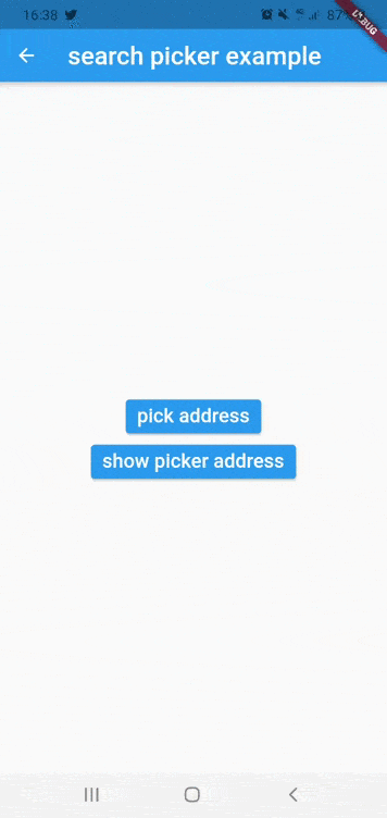
CustomLocationPicker #
customizable widget to build search location
you should use
PickerMapControlleras controller for the widget see example : search widget
Properties of CustomLocationPicker
| Properties | Description |
|---|---|
controller |
(PickerMapController) controller of the widget |
appBarPicker |
(AppBar) appbar for the widget |
topWidgetPicker |
(Widget?) widget will be show on top of osm map,for example to show address suggestion |
bottomWidgetPicker |
(Widget?) widget will be show at bottom of screen for example to show more details about selected location or more action |
NOTICE: #
For now the map working for android,iOS , web will be available soon
If you get ssl certfiction exception,use can use http by following instruction below
If you want to use http in Android PIE or above :
-
enable useSecureURL and add
android:usesCleartextTraffic="true"in your manifest like example below :<application ... android:usesCleartextTraffic="true">
if you faced build error in fresh project you need to follow those instruction #40
1) remove flutter_osm_plugin from pubspec, after that pub get
2) open android module in android studio ( right click in name of project -> flutter-> open android module in android studio)
3) update gradle version to 4.1.1 ( IDE will show popup to make update)
4) update kotlin version to 1.4.21 & re-build the project
5) re-add flutter_osm_plugin in pubspec , pub get ( or flutter clean & pub get )
Before you publish your application using this library, you should take care about copyright of openStreetMap Data, that's why i add
CopyrightOSMWidgetsee example and this issue #101
MIT LICENCE
Metadata
Publisher
unverified uploader
Metadata
OpenStreetMap Plugin Native for flutter apps (Andoird/iOS supported,web is under-dev)
Repository (GitHub)
View/report issues
License
![]() unknown (LICENSE)
unknown (LICENSE)
Dependencies
dio, flutter, flutter_osm_interface, flutter_osm_web, flutter_plugin_android_lifecycle, flutter_web_plugins, permission_handler, plugin_platform_interface, url_launcher, uuid